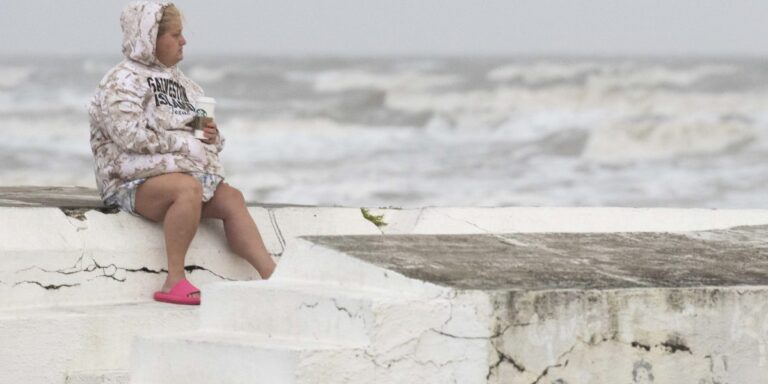
Tropical Storm Alberto formed in the southwest Gulf of Mexico on Wednesday, the first named storm of what is expected to be a busy hurricane season.
Alberto, which brings strong winds, heavy rain and flooding along the coasts of Texas and Mexico, is expected to make landfall in northern Mexico on Thursday.
“Heavy precipitation and water, as usual, is the biggest problem with tropical storms,” said Michael Brennan, director of the National Oceanic and Atmospheric Administration’s National Hurricane Center.
Alberto was located 185 miles (about 300 kilometers) east of Tampico, Mexico and 295 miles (about 480 kilometers) south-southeast of Brownsville, Texas. There were sustained winds of 40 mph (65 kph), according to the National Hurricane Center in Miami. A tropical storm is defined by sustained winds between 39 and 73 mph (62 and 117 km/h), and beyond that, the system becomes a hurricane.
Brennan said winds could reach 45 mph (72 kph) to 50 mph (80 kph) before the storm makes landfall.
Between 5 and 10 inches of rain were expected in some areas along the Texas coast, with even higher isolated totals possible, Brennan said. He said some higher elevations in Mexico could receive up to 50 centimeters of rain, which could lead to mudslides and flash flooding, particularly in the states of Tamaulipas, Coahuila and Nuevo Leon.
At the Miramar Inn hotel in Tampico, Mexico, near where Alberto was due to disembark, receptionist Diana Flores said the wind was gusty, but still not strong, and the rain had not yet started . “There are people at the restaurant and on the beach,” Flores said early Wednesday.
Outer bands of rain lashed parts of Tamaulipas state in northeastern Mexico overnight.
The storm was moving westward at 9 mph (15 km/h). Tropical storm warnings were in effect from the coast of Texas at the San Luis Pass south to the mouth of the Rio Grande and from the northeastern coast of Mexico south of the mouth of the Rio Great up to Tecolutla.
“Rapid weakening is expected once the center moves inland, and Alberto is expected to dissipate over Mexico” on Thursday, the center said.
The U.S. National Weather Service said the main risk for the South Texas coast was flooding from excessive rain. On Wednesday, the NWS said, there is “a high probability” of flash flooding on the South Texas coast. Tornadoes or waterspouts are possible.
NOAA predicts that the hurricane season that began June 1 and continues through November 30 will likely be well above average, with between 17 and 25 named storms. Forecasts call for up to 13 hurricanes and four major hurricanes.
An average Atlantic hurricane season produces 14 named storms, including seven hurricanes and three major hurricanes.
Brennan said the first named system in the Atlantic arrives on average June 20, so Alberto is “about on schedule.”
A nameless storm Earlier in June, more than 20 inches of rain dumped on parts of South Florida, stranding many motorists on flooded streets and pushing water into some homes in low-lying areas.
Brennan said there will be dangerous rip currents from the storm and drivers should watch out for road closures and turn around if they see water covering the roads.
“People underestimate the power of water and sometimes they don’t always take rainfall and the threats that come with it seriously, especially if you’re driving through an area and you see water covering the road, you don’t want to go in there,” Brennan said. “You don’t know how deep the water is. The road could be washed away by water. it only takes a few inches of moving water to move your car.


